


 Today a road runs the full length of the bay linking the two towns. The busiest stretch from West Park to Bel Royal is called Victoria Avenue. Construction of this road, now a dual carriageway, was not undertaken until the final years of the 19th century, before which traffic passed further inland on St Aubin's Road. The Jersey Railway line ran along the shoreline from 1870, and before that low sand dunes were washed by the high tide and the quickest way to drive a horse and cart from one end of the bay to the other was along the beach at low tide. When St Aubin was the island's principal port and St Helier was beginning to develop as a population centre, but without its own port, this is exactly how imported goods were moved from one town to the other


Click on any image to see a larger version

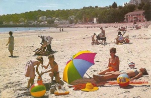
1952

1950

1920s
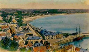


The bay in 1893

The bay in the 17th century

The bay in 1970

Later in the 19th century a small village is developing at Beaumont


St Aubin's Bay by Ouless. St Matthew's Church, the coastal tower, now demolished, and windmill, stand isolated in the centre of the bay


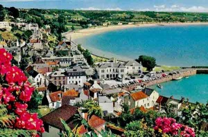
La Haule to Beaumont


1933 aerial photograph by Aerofilms

1933 aerial photograph by Aerofilms

1956

An aerial view sent as a postcard in 1937, but probably taken in 1933

Looking towards Bel Royal in the bottom left, Beaumont, La Haule, and beyond to Saint Aubin


On the beach at St Aubin in 1909

From a 1949 calendar

La Haule before a road was built]]

For many years a windmill stood on the Martello tower at First Tower

Beaumont in 1863 before the coast road was built

People's Park at the eastern end of the bay in 1893 just before Victoria Avenue was built


.jpg)


.png)